Taf Fechan River Walk
This is a moderate, circular walk in woodland alongside the Taf Fechan (not suitable for wheelchairs or those with very limited mobility).
This is a moderate ,circular walk in woodland alongside the Taf Fechan with seats in places. Not suitable for wheelchairs or those with very limited mobility. There is a bridge with a couple of low steps at the start at Owl’s Grove car park.
Turn left for a level walk along the river although the path is uneven in places with tree roots and a couple of small stream crossings. A wider path with chippings and ending in several steps leads up to Pont Cwmyfedwen carpark.
Turn right for a short climb uphill along a narrow soil or chippings track. The path meets a wide forestry track sloping downhill to Cwmyfedwen car park.
Of interest
Mobile phone reception can be poor here.
Public transport: Not accessible by public transport.
Parking: Owl’s Grove and Pont Cwmyfedwen car parks are large with a compacted stone surface.
Nearest EV Charging: Victoria Street Car Park, Dowlais, Merthyr Tydfil, CF48 3RN
Facilities: . There are several pubs and cafes locally and also in Merthyr Tydfil. There are a number of accessible picnic facilities nearby and further way-marked walks in the area.
Toilets: The nearest disabled toilets are at the Brecon mountain railway. Toilets, including disabled toilets, are at Pant and Pontsticill stations. Pant railway station is north of Merthyr at Pontsticill Rd, Pant CF48 2DD. Follow the train symbol on brown signposts from the A465..
Grade 2
Moderate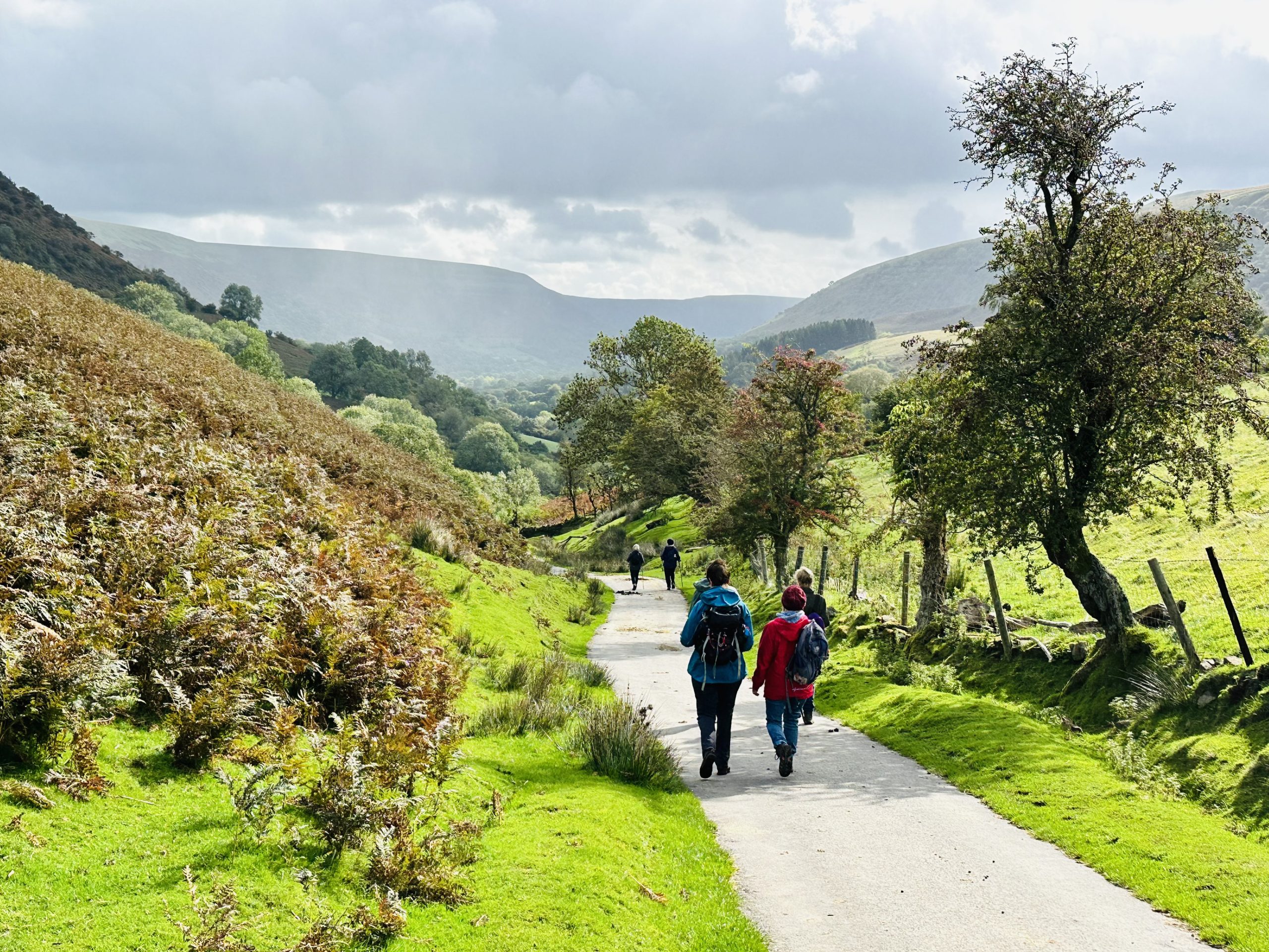
Beth hoffech chi weld?

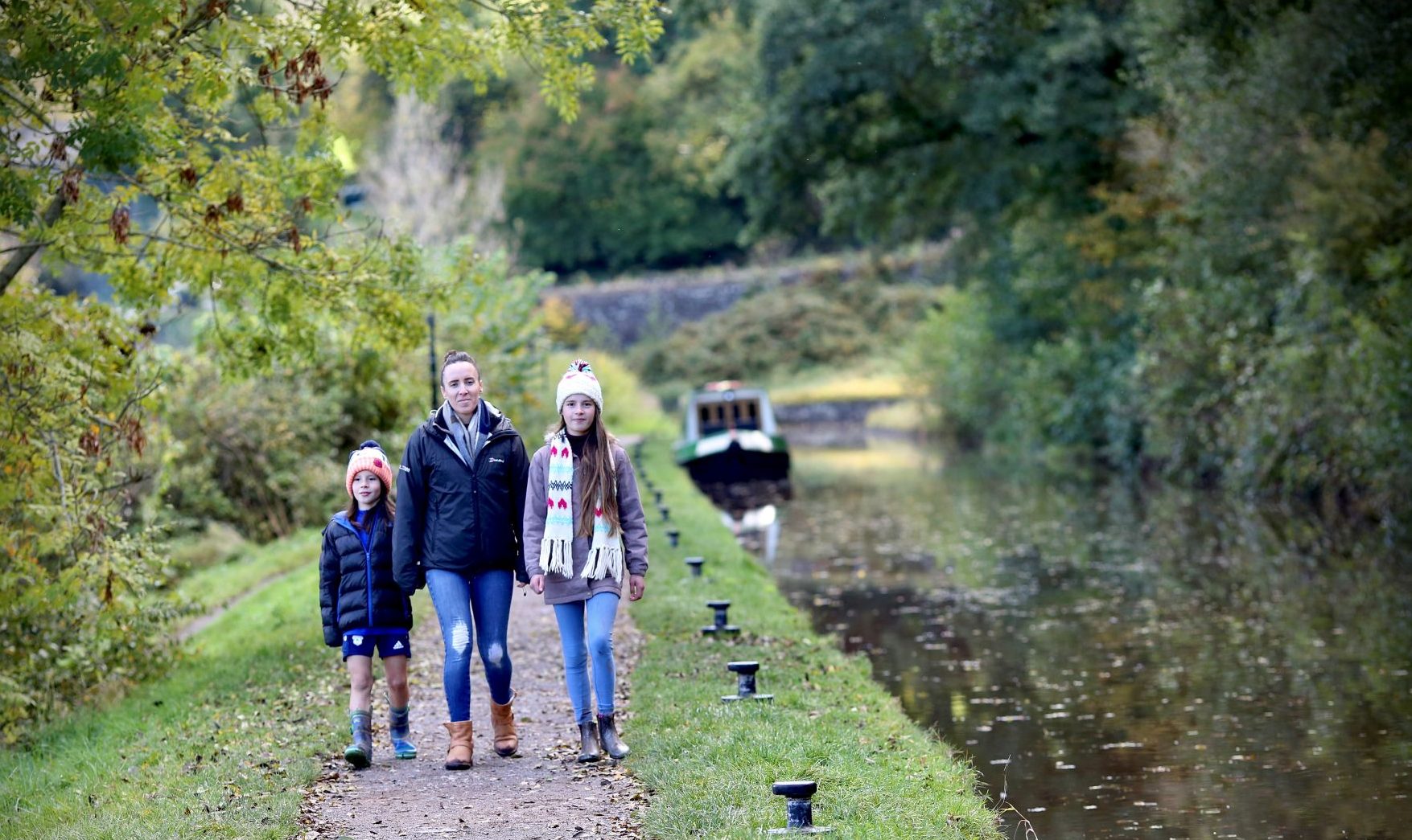
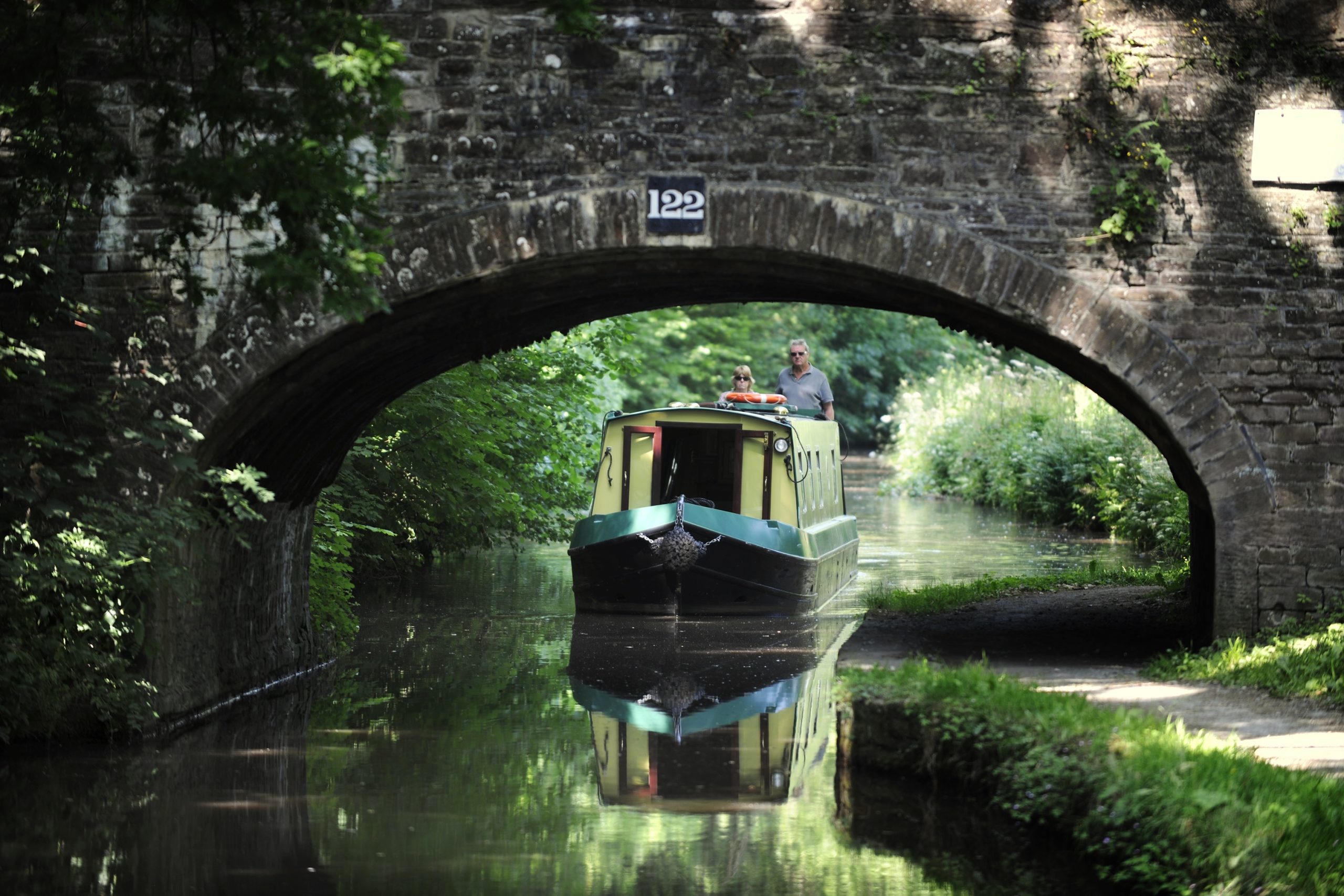
Monmouthshire and Brecon Canal towpath
This is one of the most scenic and spectacular canals in the UK.
You can join the towpath for as much walking as you prefer as it winds over 30 miles/50km between Brecon and Cwmbran and has good views over farmland, woodland and mountains
The canal is home to a wide range of wildlife and plants.
The towpath is generally flat and of compacted soil or gravel, but access on to it varies from place to place and some have short, steep inclines.
There is occasional seating. Headroom and the path width are often restricted at bridges.
Of interest
Fishing is allowed on stretches of the canal. For details of fishing permits please check the Canal and Rivers Trust for details.
Public transport Bus 43 (TC) Brecon-Abergavenny runs alongside the canal between Brecon and Crickhowell. Check Traveline Cymru for buses beyond Llangattock.
Parking: Small car parks are situated by the canal side at several locations, allowing level or easy access onto the towpath.
Nearest EV Charging starting in Brecon: Morrisons Brecon, Free Street, LD3 7SE. There are other charging points along the canal.
Facilities: There are villages with pubs and cafes close to, and alongside the canal.
Grade 2
Moderate
Pethau i'w gwneud
Priory Groves, Brecon
Priory Groves is woodland in the Honddu river valley. It stretches from below the Cathedral towards the village of Llanddew.
Priory Groves is woodland in the Honddu river valley. It stretches from below the Cathedral towards the village of Llanddew.
A haven for a variety of birds and wildlife, the trees are mainly beech and in spring there are carpets of wood anemones, then bluebells. Later, the Groves are filled with beautiful autumn colour.
There are a variety of footpaths, some level tarmac or gravel, some steeper and rough underfoot.
There are no stiles and some seats. Easier access along the river path is only possible up to the first gate. It can get muddy during heavy rain. There are maps and information at the Cathedral and Struet entrances.
Of interest
Public transport: Town buses 40A and 40B (TC) stop near the Cathedral entrance.
Parking: There is a pay and display car park with disabled spaces next to the Cathedral and access to the Groves through a wide gate. You may find on street parking near other access points.
Nearest EV Charging: Morrisons Brecon, Free Street, LD3 7SE
Facilities: These are in Brecon Cathedral, there is an accessible café on site and a gift and book shop next door in the tithe barn. There are many cafes, pubs and shops in the town centre.
Toilets: These are in Brecon Cathedral, the toilets, including a disabled access toilet, are situated next to the café and there are also toilets in the cathedral itself.
Grade 2
Moderate
Beth hoffech chi weld?
Sychryd All Ability Trail / Dinas Rock
Short route suitable for wheelchair or mobility scooter users, path winds between the river and the rock face.
This ¼ mile/400 metre long, level route.
Suitable for wheelchairs and mobility scooters.
It winds through a narrow, wooded gorge carved by the Afon Sychryd at Pontneddfechan. With the river on one side and a rock face towering above, it makes for a spectacular short walk.
The route is mainly compacted stone-dust with some short stretches of compacted earth, which can get muddy after long spells of rain. There is a short ramp leading up to the main path from the car park
Of interest
Nearest EV Charging: High Street Car Park, Hirwaun, Aberdare, CF44 9SW
Facilities: There are two pubs, a shop and café at Pontneddfechan, and the village hall’s community run café close by Dinas Rock car park opens at certain times. You will pass Rhos Filling Station and shop on the road to Ystradfellte where there is a pub.
Toilets: There are public toilets with disabled access in Pontneddfechan and an accessible toilet at the community café and hall when open.
Public transport: Bus Service 161 Mon- Fri (TC) Neath to Min yr Awel
Grade 1
Easy
Beth hoffech chi weld?
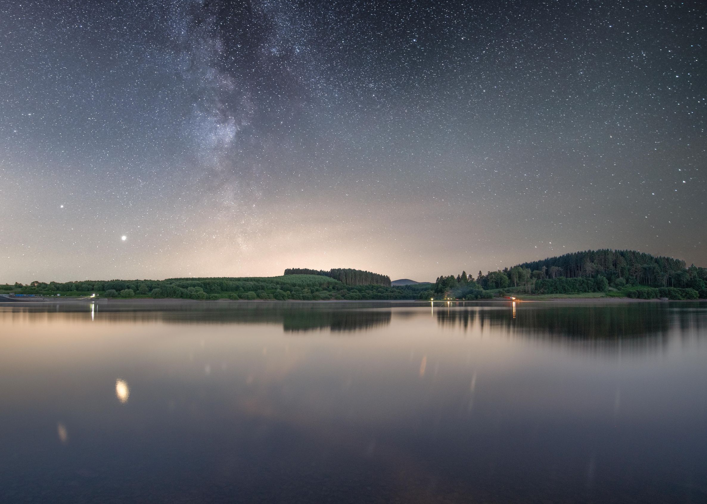
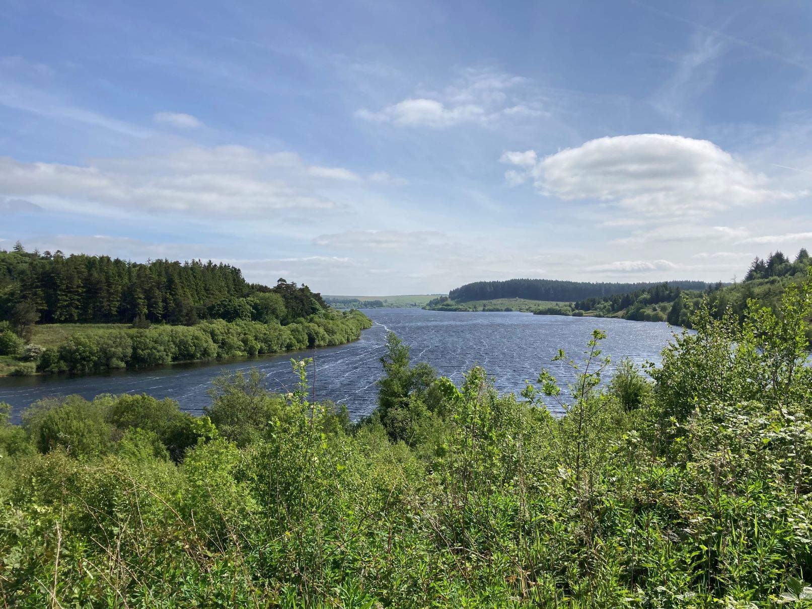
Usk Reservoir
Remote, but beautiful, Usk Reservoir is circled by a mainly stone track, the longer slopes are downhill if you walk clockwise.
The Usk Reservoir is in a remote area surrounded by forest and moorland overlooking Mynydd Du/ The Black Mountain. There is an 8km circular trail which winds its way around the reservoir. The surface is a mix of compacted-stone forestry tracks and tarmac roads.
There are lots of opportunities for shorter strolls, both on tarmac and on the tracks.
The trail is undulating with some long slopes – heading in a clockwise direction means that many of the longer slopes will be downhill. The route is also used by cyclists and walkers. Fishing is available with concessionary rates – pay in the shed on the north side of the reservoir. There are good views of the lake and surrounding countryside from the car parks.
Of interest
Fishing is available with concessionary rates – pay in the shed on the north side of the reservoir.
There are good views of the lake and surrounding countryside from the car parks.
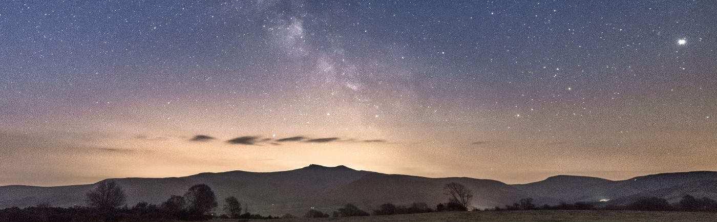
This is also an ideal spot to stargaze as the hills protect if from light polllution.
Grade 3
Challenging
Beth hoffech chi weld?
Offa’s Dyke National Trail
Crossing the border between England and Wales more than ten times in its 177 mile (285km) length, the Offa’s Dyke Path passes through the Bannau Brycheiniog (Brecon Beacons) National Park.
The part of the trail within the National Park, enters near Llathony Abbey and leaves at Hay on Wye, running around 15 miles (about 25km) along the North Eastern border of the National Park, over the Black Mountains.
Of interest
Offa’s Dyke’ itself is a bank and ditch dug by hand in the 8th century for King Offa of the ancient Anglo-Saxon kingdom of Mercia. It was probably intended to divide Mercia from rival kingdoms in what is now Wales, and some sections still form the England/Wales border today.
Offa’s Dyke is one of 15 National Trails for you to explore in England and Wales. ‘
Grade 4
Very challengingBeth hoffech chi weld?
Penderyn Mineral Line walk
Walking along this former tramway which links Penderyn and Hirwaun, can you spot birds and wildlife alongside any remains of the route’s industrial origins?
Come and discover a hidden corner of the National Park by walking along this former tramway, which links Penderyn and Hirwaun. The route follows an old tramway from Penderyn to Hirwaun, which linked the limestone quarry to the ironworks.
Known locally as the Arcway, you’ll have an excellent opportunity to do some wildlife spotting whilst looking out for signs of the route’s industrial origins.
This is a grade 2 walk: Routes with some sections with slightly looser surfaces, slight gradients and gates but no stiles, there are some seats. The gentle route has a compacted stone surface but can get muddy in places after long spells of rain. Of necessity, there are also anti-motorcycle barriers at either end and along the trail, but these should not cause access issues for most users
As you wander along this old quarry line, fringed with flowers and trees you will probably hear birdsong in spring and summer accompanying the burbling sound of Afon Cynon, the nearby river which flows alongside.
The relative tranquillity of today is a far cry from the time when horse-drawn trams hauled tonnes of limestone and silica rock from the quarries at Moel Penderyn to the ironworks at Hirwaun along this line, which was built in the 1780s. It would have resounded with even louder noises when after 1904 steam and then diesel locomotives replaced the horses.
If you pair your phone with the Hirwaun Audio Trail you can listen to the stories of the ‘ghost’ of William Bryant – once a worker at Hirwaun Ironworks.
Of interest
Public Transport: Bus 8 Aberdare to Glyneath via Penderyn(TC)
Parking: Roadside parking in Penderyn and in Hirwaun.
Nearest EV Charging: Penderyn Distillery, Penderyn, Aberdare, CF44 0SX
Facilities: There are two pubs in Penderyn, but no other facilities nearby. The closest shops are in Hirwaun.
Toilets: There are toilets in Hirwaun, one with disabled access.
Grade 2
Moderate
Beth hoffech chi weld?
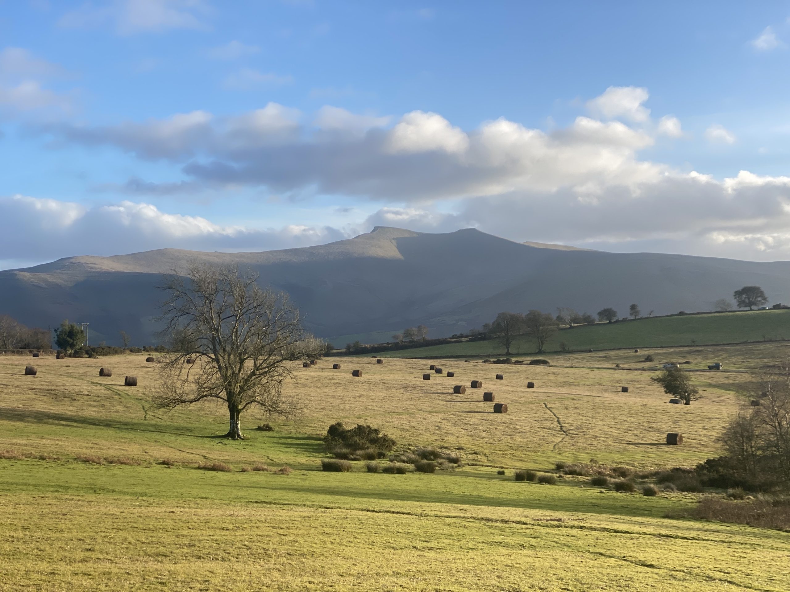
Taith Gerdded Comin Mynydd Illtud
Cyfle i gerdded yn ling-di-long neu i glirio’r pen, mae mynd am dro dros dir comin Mynydd Illtyd yn cynnig rhywbeth i bawb a’r cyfan dafliad carreg o gyfleusterau Canolfan Ymwelwyr y Parc Cenedlaethol.
Mentrwch allan i weld golygfeydd panoramig o’r pedwar clwstwr mynyddoedd sy’n ffurfio Bannau Brycheiniog. Llwybr gradd 2 yw hwn – sef llwybrau sydd â wyneb rhydd dan draed ar brydiau, goleddfau ysgafn a gatiau ond dim camfeydd. ‘Does fawr o le i eistedd ar y llwybrau hyn chwaith.
Of interest
Uchafbwyntiau
Cadwch olwg fry uwch eich pen er mwyn gweld y barcud coch ar adain y gwynt ar berwyl i chwilio am ysglyfaeth efalallai. Mae’r meistri hyn â’u hadenydd yn hwylio’n ddidrafferth ar y ceryntau aer gan droi a throelli eu cynffonau fforchiog. Yn y gwanwyn a’r haf bydd cyfle i weld a chlywed cân yr ehedydd, tinwen y garn a chlochdar y cerrig hefyd wrth iddyn nhw chwilio’n brysur am gymar, neu godi nyth a magu cywion. Wrth i chi sefyll ar Twyn y Gaer â’i olygfeydd eang draw am Pen-y-fan a’r Corn Du, y Mynyddoedd Duon ac Afon Wysg yn nadreddu oddi tanoch, oedwch ennyd i ystyried y bobl hynny a fu’n byw yn y fryngaer hon yn yr Oes Haearn. Yn ystod y 1990au fe gafodd yr eglwys o’r G19 a fu gerllaw, ac a gysegrwyd i Illtud Sant, ei dymchwel, ond mae enw’r mynach Celtaidd hwn yn dal yn fyw ar y tir comin.
Grade 3
Challenging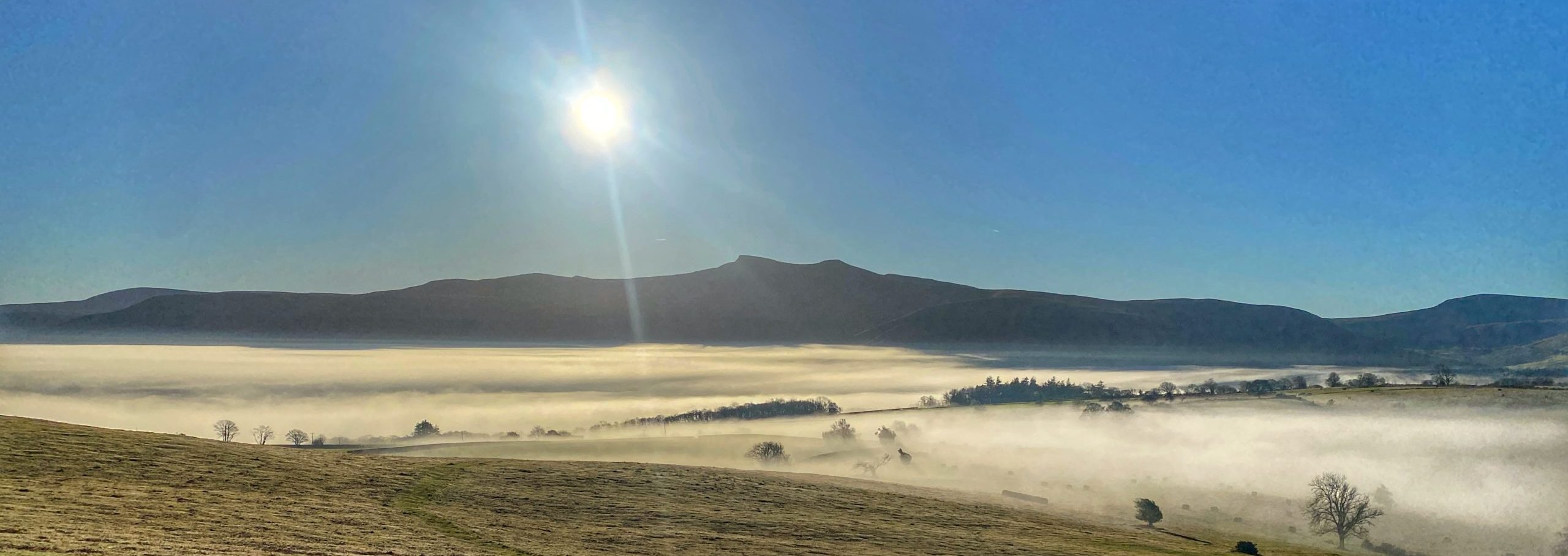
Beth hoffech chi weld?
Craig- y-Nos Country Park walk
A short but varied walk leads through the pretty Country Park – the former pleasure gardens of Craig-y-Nos castle, past lakes and ponds.
This short but varied walk leads through the former pleasure gardens of Craig-y-nos castle, past lakes and ponds and provides striking views down the Upper Swansea valley. This is a grade 1 walk – routes which are barrier free, have negligible gradients and solid or compacted surfaces, offers seats. There is a car park and cafe on the site.
Of interest
Step into the opulent world of Adelina Patti, the late 19th century diva, who established this park as a setting for her mansion, Craig-y-Nos castle.
Walk in her footsteps around her former garden and explore the lawns, meadows, woodlands, lakes and river banks.
See the oak tree planted by Madame Patti in 1914 to commemorate her last performance at the Royal Albert Hall, given in aid of victims of World War I.
You will also pass the Garden Pavilion, built to perform summer concerts in, and as a changing area for Patti’s guests to play tennis or croquet.
As you pass the two lakes spare a thought for those who dug them out by hand – Patti had a 40 strong team of gardeners here.
You may also spot Adelina Patti’s monogram on the white metal bridge and a bed of roses near the fish-pond, planted to commemorate the centenary of her death in 2019.
Grade 1
EasyBeth hoffech chi weld?
Llanddeusant to Carreg Cennen Castle (Beacons Way – day 7)
Llanddeusant to Carreg Cennen Castle (Beacons Way – day 7) This day passes through areas of wild, open and, in places, pathless country, only attempt this in good conditions unless you are skilled and experienced at navigation.
Llanddeusant to Carreg Cennen Castle (Beacons Way – day 7)
Start point: Llanddeusant (SN 776245)
Finish point: Carreg Cennen Castle (SN 666193)
Distance: 20.5km / 12.5 miles
Ascent: 660m / 2170ft
Difficulty: Hard
Time: 6 hours
Day seven requires good navigational skills as the majority of the route is on unmarked, open moorland. The route is not particularly arduous but you do feel you are out in the wilds. You will pass two impressive Bronze Age cairns when you reach the summit of Garreg Las and you will be able to see the next summit of Foel Fraith.
You will be unlucky not to spot the iconic Red Kite along with a variety of other birds of prey. Wheatears breed here in the summer and can be seen scurrying across the ground or flying from perch to perch. Carreg Cennen Castle comes into view at the end of a long day. The castle ruin is perched on the top of a 100 metre limestone crag and is worth a visit. Take a torch to explore the cave.
Directions:
This day passes through areas of wild, open and, in places, pathless country.
Only attempt this in good conditions unless you are skilled at navigation.
From Llanddeusant, follow the road south until just before the farm at Gellygron where you follow a track to the left. 200 metres on from the road, keep left at the junction and head uphill on the rocky floored green lane to the point where it meets the open hill.
The path heads south towards Carreg yr Ogof and is reasonably easy to follow. Once there is a clear view of the high ground, the route skirts to the left of the direct route to summit. As you approach Carreg yr Ogof, be careful not to be drawn left by the bridleway but, instead, head south-west towards the trig point.
From the trig point, head directly south to the summit of Garreg Las, initially picking your route through the limestone rocks of Carreg yr Ogof and then up the grassy slopes to the summit of Garreg Las and its twin Bronze Age burial cairns.
From here, the route continues along the top of the ridge and care must be taken to follow the paths between the gritstone boulders to reach the rocky pavements further south.
There is no safe way off to the west until you have cleared the gritstone boulders and pavements but, once past, you can head due west moving down into an area of scattered ponds. Now aim north of the summit of Foel Fraith towards a small quarry on the horizon, to the south of the steep ground which falls to Blaen y Cylchau. Head north of the summit but above the steep ground, aiming to pass over the shoulder of the hill to descend to the plateau below.
Please avoid the summits of Foel Fraith and Moel Gornach to prevent disturbance to the rare bird populations there.
Take a diagonal line and contour around Foel Fraith’s lower slopes, aiming for the tree in a shakehole at SN 752 187 and then pass to the south of that tree, avoiding the boggy area in the lower ground. Aim for the middle level of the Black Mountain Quarry complex in the distance and contour around the northern flanks of Moel Gornach to reach it at road level. Walk through the quarry, passing just above the car park, and cross the A4069. Pass north of the sand quarries and then head up onto the flanks of the hill, aiming to pass just below the crags and scree, again avoiding ecologically sensitive land to the south. Next, take a diagonal line trending gradually towards the minor road, picking your way through the small quarries, with the aim of meeting the road at its western end by Clogau Mawr. Where there are quarries below keep away from their edges. In poor visibility, it may be better to pick a route down to the minor road and follow it west but do not use the dangerous main road for this.
Join the road for a short distance, then take the bridleway west for 350m and north for 200m returning to the road. Soon, turn left onto the westerly path through Pentre Blaencennen for around 1km. This peters out just after passing the lower flanks of Carn Fawr. From this point, head west aiming for a saddle in the distance, and so up onto an old tramroad onto another minor road. Follow this road for 1.3km and then turn right at the T junction past Brondai Farm. Be aware that the path can be quite muddy past the farm during wet weather. Follow the path down through the woods, over the river, then turn back to the west to make the final climb up to Carreg Cennen Castle. Although there is a day time tea room here, there is no accommodation. Don’t forget to arrange for a taxi to pick you up at the end – mobile signal may be poor.